Learn more about Logistics, Routes, Segments, and Distance, Safety, Travel, Weather, and History. You can email us a question using our contact form or comment below.
Logistics
Where can I park?
There are several parking options for those planning to ride up Mount Lemmon. The recommended parking location is the Le Buzz Cafe / Safeway parking lot, which is 4.5 miles from the start point at milepost zero. Limited roadside parking is available at milepost zero itself. On weekends, cyclists can also park at Tanque Verde High School. Another option is McDonald Park, located off North Harrison Road.
Where can I get water along the route?
There are no water sources available until Bigelow Trailhead, located past mile marker 19. It is essential to carry sufficient water to sustain yourself throughout the climb. A good rule of thumb is one bottle per hour, and slower cyclists may benefit from carrying a hydration backpack for additional water capacity.
Where can I buy food on Mount Lemmon?
Food options are available at the end of the climb in Summerhaven. Cyclists should plan to be self-supported until reaching the top. Popular spots include the Mount Lemmon Cookie Cabin, which serves oversized cookies and pizza from 11 AM to 5 PM. Beyond Bread, which opened a location in 2024, is another option with operating hours from 7 AM to 7 PM. The Mount Lemmon General Store is a great place to pick up snacks or their famous fudge, open from 10 AM to 6 PM. For those looking for a sit-down meal, table service restaurants include Sawmill Run (10 AM to 5 PM) in Summerhaven and Iron Door Restaurant in the Ski Valley.
How much water and food do I need to bring?
Since there are no food stops until the end of the climb and no water sources before mile marker 19, cyclists should come prepared. A general guideline is to carry one bottle of water per hour and consume at least 240 calories (60 grams of carbohydrates) per hour. During the warmer months, electrolytes are highly recommended to maintain hydration and prevent cramping.
How long does it take to ride up Mount Lemmon?
The time required to ride up Mount Lemmon varies depending on fitness level and experience. Competitive cyclists may complete the climb in under two hours, while intermediate riders typically take between three to five hours. Beginners or those riding at a relaxed pace may take five or more hours to reach the top.
What kind of bike do I need to ride up Mount Lemmon? Can I ride a tri bike or mountain bike?
A road bike is strongly recommended for climbing Mount Lemmon due to its lightweight frame, low rolling resistance tires, and adequate gearing. The most critical factor is ensuring your bike has sufficient gearing for your ability level. Many road bikes and triathlon bikes have cassettes that may not provide an easy enough gear for sustained climbing. An intermediate rider should have at least a 28-tooth cog on the largest rear gear for a comfortable cadence.
Many triathletes successfully climb Mount Lemmon on a tri bike, though they should expect to spend most of the climb riding on the base bar rather than in the aero position. Mountain bikes have easier gearing and are a viable option, though they are significantly heavier and slower due to wider tires and greater rolling resistance. Some mountain bikers ride up the highway to access the trails for a descent. While it is possible to complete the entire climb on a mountain bike, it will take considerably longer than on a road or tri bike.
Routes, Segments, and Distance
Where is the summit for road cycling?
The official summit of Mount Lemmon is at the observatory, past the Ski Valley. To reach this point, cyclists must turn right before entering Summerhaven and follow the road up to the observatory. The Strava segment “MP0 to Observatory” tracks this climb. However, many cyclists opt to stop at the highest point on Catalina Highway, located just before Whitetail Campground, past mile marker 20. This alternative stopping point is tracked by the “Mount Lemmon Official” Strava segment.
Many cyclists choose to end their climb at the Catalina Highway high point rather than the true summit for several reasons:
- Many cyclists are simply unaware that the true summit is beyond Ski Valley.
- The final section from Catalina Highway to the observatory is steeper, averaging close to a 7% grade compared to the 4.7% average grade of the main climb.
- In winter, the Ski Valley often has snow, making the road conditions more challenging.
- Stopping at the Catalina Highway high point allows cyclists to reach Summerhaven sooner for food and drinks.
- The gate to the observatory is closed to cars, requiring cyclists to go around it.
How far is it from the base to the top, and what is the total elevation gain?
The climb begins at mile marker zero, which is at an elevation of 2,858 feet (871 meters). The full ascent covers 27.8 miles (44.7 km) and reaches the observatory at 9,134 feet (2,784 meters), resulting in a total elevation gain of 6,276 feet (1,913 meters).
How steep is it? What is the average percent grade?
The average grade for the main climb along Catalina Highway is 4.7%. If continuing to the observatory, the overall average grade drops slightly to 4.2% due to flatter sections between Summerhaven and the turn toward the summit. However, the final segment from Catalina Highway to the observatory is steeper, averaging close to 7%.
Overall, Mount Lemmon is considered a gradual climb and is not very steep. The difficulty comes from the long length of the climb. In comparison, one of the most famous climbs in Europe, Mount Ventoux, has a distance of about 13 miles (roughly half the Mount Lemmon climb), but a grade of around 7.5%.
Where can I download a route for my bike computer or phone?
We provide routes through Google MyMaps, Ride with GPS, and Strava. These platforms allow cyclists to download and follow routes on their bike computers or phones for easy navigation.
Are there signs or mile markers along the way?
Mile markers are posted along Catalina Highway, starting from mile marker zero and continuing up to mile marker 23. As of March 2025, the marker at mile 5 is missing.
What are the main Strava segments on Mount Lemmon?
There are two primary Strava segments for Mount Lemmon:
- MP0 to Observatory: Tracks the full climb to the true summit at the observatory.
- Mount Lemmon Official: Ends at the highest point on Catalina Highway, just before Whitetail Campground.
For cyclists who don’t want to tackle the entire climb, check out the segment to Windy Point (mile marker 14).
Who holds the fastest time (KOM and QOM)?
As of March 2025, the current fastest times on Strava are:
- MP0 to Observatory: Tyler Stites (1:42:55 in 2020) and Morgan Cabot (2:20:15 in 2015).
- Mount Lemmon Official: Lionel Sanders (1:11:43 in 2020) and Lauren De Crescenzo (1:28:03 in 2023).
Safety
Is there a dedicated bike path, or will I be riding with cars?
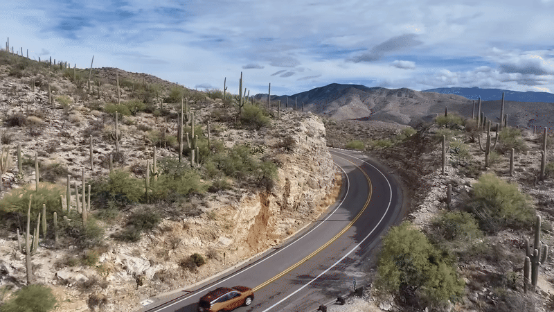
There is no dedicated bike path on Mount Lemmon. However, the ascent features a wide shoulder that provides ample space for cyclists. On the descent, the shoulder is narrower, and cyclists should take extra caution while riding down, particularly around curves where vehicles may encroach on the shoulder.
What is the road quality like? Is it bumpy?
The road quality is generally very smooth until around the Catalina Highway high point. Around Mile Marker 21, the pavement has more cracks and bumps due to freeze-thaw cycles at higher elevations. Thanks to advocacy from the Mount Lemmon Bikeway Coalition, the first three miles of the highway were repaved in 2024, ensuring a smoother start to the climb.
What is the closest bike shop to Mount Lemmon?
The closest bike shop to Mount Lemmon is Sabino Cycles, which is located approximately 3 miles from the recommended parking area at Le Buzz Cafe / Safeway. Cyclists should carry supplies and be prepared to fix their own flat tires.
Is there cell phone service on Mount Lemmon?
Cell phone service is spotty from around mile marker 5 until Summerhaven at the top. Coverage varies by provider, with Verizon generally offering the best reception. Cyclists should not rely on having a signal for navigation or emergency calls and may want to carry a GPS device with offline maps or a satellite communicator for added safety.
How many cyclists have died on Mount Lemmon?
Cycling on Mount Lemmon is generally considered very safe. However, there have been a few recorded fatalities:
- September 30, 1999: Mount Lemmon Highway is named in honor of Brad Gorman, a local cyclist who was killed by a reckless motorist while riding on Mount Lemmon. His family and friends advocated for cyclist safety, leading to the highway’s dedication in his memory.
- June 29, 2013: 57-year-old cyclist Karl Gerschutz died while descending near Rose Canyon Lake. He lost control of his bicycle on a curve, left the road, and collided with the side of a hill, resulting in fatal injuries. Investigators determined that no other vehicles or external factors contributed to the crash.
- July 13, 2024: Jean Philippe (JP) Galons, a University of Arizona professor, had a cardiac emergency while cycling on Mount Lemmon and passed away.
Are there any weather conditions that make cycling unsafe?
Yes, certain weather conditions can make cycling on Mount Lemmon hazardous:
- Monsoon season: From July to September, afternoon thunderstorms can produce heavy rain, lightning, and flash floods. Riders should plan to finish their ride before midday during monsoon season.
- Temperature differences: The temperature at the summit can be 20-30°F colder than at the base, especially in the winter months. Cyclists should dress in layers and carry extra clothing for the descent. Read more about monthly temperatures on our weather page.
- Ice and snow: During winter (December through February), ice can form on the road, particularly in shaded areas. Snowfall may also cause closures.
- Strong winds: Wind gusts exceeding 30 mph can occur, particularly in the afternoon. Checking wind conditions before riding is advised.
Does Mount Lemmon ever close due to snow?
Yes, the Pima County Sheriff’s Department closes the road to two-wheel-drive vehicles and cyclists if there is significant snowfall. The road closure is typically enforced at the base of the mountain, and access is restricted until conditions improve. To get up to date road conditions you can call the Pima County Road Condition HotLine +1 (520) 351-3351. The Mt Lemmon Weather and News Facebook page also tends to have recent information on conditions.
How windy does it get on the mountain?
Mount Lemmon can experience wind gusts over 30 mph, particularly in the afternoons and near exposed sections of the climb. Cyclists should check the wind forecast before riding and exercise caution when descending.
Is there a hospital on Mount Lemmon?
There is no hospital on Mount Lemmon. The nearest medical facilities are in Tucson, with Tucson Medical Center and Banner University Medical Center being the closest major hospitals. In the event of an emergency, Pima County Search and Rescue may be deployed to assist.
Travel
Do I need to have a car or rent a car to get to Mount Lemmon?
You do not necessarily need a car to reach Mount Lemmon. Tucson features The Loop, a 131-mile bike path that connects various parts of the city. Depending on your lodging location, you may be able to bike to the base of Mount Lemmon. However, Tucson is geographically large, and if your accommodation is far from the mountain, renting a car may be more convenient.
What airport should I fly into?
- Tucson International Airport (TUS): The closest airport, located about a 40-minute drive from Mount Lemmon’s base.
- Phoenix Sky Harbor Airport (PHX): A larger airport with more flight options, located approximately two hours away by car.
Are there bike rental shops in Tucson?
Yes, there are several bike rental shops in Tucson. One of the most reputable options is Fairwheel Bikes, which offers high-performance road bikes suitable for climbing Mount Lemmon. Other rental shops in the area also provide road and mountain bike rentals.
Weather
What’s the weather like on Mount Lemmon?
The weather on Mount Lemmon varies significantly by season and altitude. Read more on our weather page. At the base, the climate is hot and dry, while the summit has cooler temperatures and more precipitation. If there is too much snow, the road is closed to bicycles. To get up to date road conditions you can call the Pima County Road Condition HotLine +1 (520) 351-3351. The Mt Lemmon Weather and News Facebook page also tends to have recent information on conditions.
How much colder is it at the top than at the bottom?
The summit is typically 20-30°F (11-17°C) colder than the base. During winter, temperatures at the top can drop below freezing while it remains mild at the bottom.
Does it get very hot in the summer?
Yes, Tucson experiences extreme summer heat, often exceeding 100°F (38°C). However, temperatures on Mount Lemmon are significantly cooler at higher elevations, making it a popular summer escape.
Does it snow on Mount Lemmon?
Yes, Mount Lemmon receives regular snowfall in winter. The summit area, including the Ski Valley, can accumulate several feet of snow each year.
What months have the best weather for cycling on Mount Lemmon?
The best months for cycling are March through May and October through early December, when temperatures are moderate, and weather conditions are more predictable.
What months have the best weather for cycling on Mount Lemmon?
The best months for cycling are March through May and October through early December, when temperatures are moderate, and weather conditions are more predictable. However, many cyclists enjoy Mount Lemmon year round.
Is there a monsoon (rainy) season?
Yes, monsoon season occurs from July through September. Afternoon thunderstorms with heavy rain, strong winds, and lightning are common. Riders should plan to complete their ride before midday during these months.
Where can I check the current weather before my ride?
Basic weather conditions are available on the current weather section of this site. The most advanced forecast is available on Mountain Forecast. You can also check myWindsock for a detailed view of the wind conditions (headwind/tailwind).
What should I wear for the ride based on the weather?
- Winter (December–February): Thermal layers, gloves, a windproof jacket, and insulated leggings. However, always check the weather for unseasonably warm days!
- Spring/Fall (March–May, October–November): Light layers with a wind jacket for the descent.
- Summer (June–September): Lightweight, breathable clothing, sun protection, and plenty of hydration.
History
How did Mount Lemmon get its name?
Mount Lemmon is named after Sara Plummer Lemmon, a botanist who explored the mountain in the 1880s with her husband, John Gill Lemmon. She was the first non-Indigenous woman to reach the summit.
How was Mount Lemmon formed?
Mount Lemmon is part of the Santa Catalina Mountains, formed by tectonic activity and erosion over millions of years. The region features exposed granite and diverse geological formations.
Has there ever been a cycling race up Mount Lemmon?
Yes, there have been cycling races on Mount Lemmon in the past. A time trial event used to take place, but rather than finishing at the top, it initially ended at Bear Canyon Picnic Area. The course was later shortened to finish at Seven Cataracts Vista to protect a pair of spotted owls in the area. The last edition of this time trial was held in 2015.
Additionally, there was a gravel race called the Mount Lemmon Gravel Grinder, which took place on the unpaved back side of the mountain. This challenging event attracted gravel and adventure cyclists, offering a unique way to experience Mount Lemmon’s rugged terrain. The last running of the gravel race was in 2021.
Sadly, there currently aren’t any cycling races on the mountain.
Planning to ride up Mount Lemmon mid November
The FAQs note there is water at MM 19. Thank you! Question: I climbed the route virtually on Rouvy and noticed a rest area / bathroom sign at the Windy Point Vista at MM 14. Is that a viable option?
I look forward to your reply
Coming to town for the Tour de Tuscon on the 22nd, and I’ll be ascending Lemmon on Nov 19th and just wanted to double-check.
There is a bathroom at Windy Point, but it is only pit toilets. There is no running water. Enjoy El Tour and Mount Lemmon!